LIS Pro 3D - tools for processing point clouds


Additional Thematic Packages


LIS Pro 3D is a commercial extension for the free and open source GIS SAGA, which provides tools for the professional processing of 3D point cloud data. The software is a fully modular and fully automatable (command line scripting, Python, C++) processing engine that runs on 64-bit GNU/Linux and Windows operating systems.
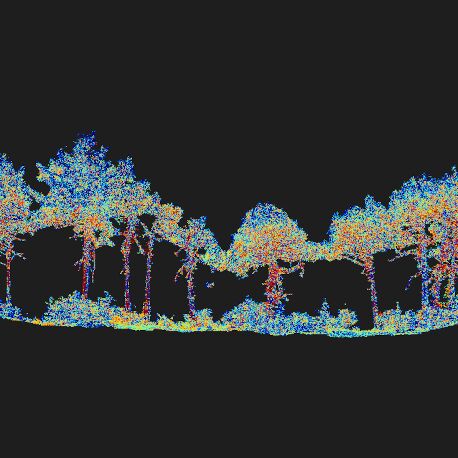
LIS Forestry
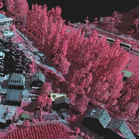
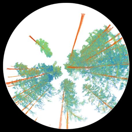
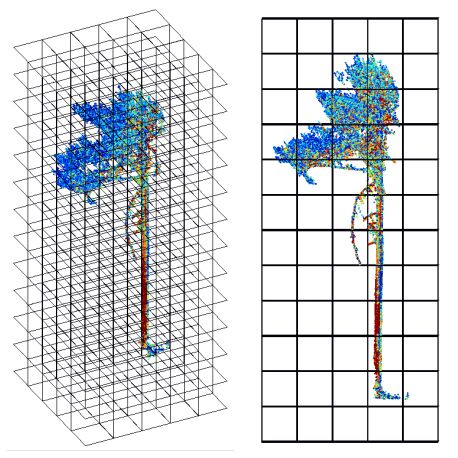
The package contains tools for forest masking,
crown coverage computation,
single tree derivation, tree shape metrics, creation of 3D vector models of trees and volume
calculations (biomass, stem volume).
Applications include silvicultural analyses and management and the creation of map layers
for tree cadastres.
Part of the functionality of this package is also available in the LIS TreeAnalyzer plug-in
for the Riegl RiSCAN PRO software.
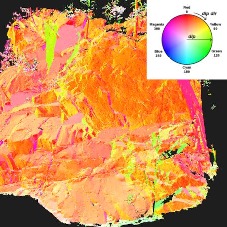
LIS Geology
The package contains tools for structural geology,
including tools to derive the bedding
orientation from lineaments, to create pole plots, to derive discontinuity sets and joint
planes, to calculate joint spacings,
and to perform kinematic failure analyses. Applications are slope stability analyses and the
derivation of block sizes.
Part of the functionality of this package is also available in the LIS GeoTec plug-in
for the Riegl RiSCAN PRO software.

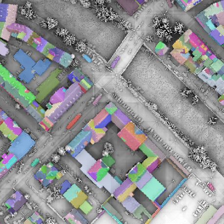
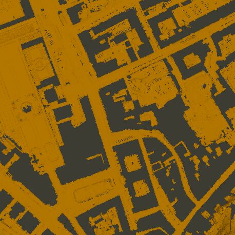
LIS City Modeller
The package contains tools for the automatic delineation of building footprints (LOD0) and building models (LOD1 and LOD2) from point cloud data. Applications are map layers and 3D city models, which can be enriched with further information.
LIS Road Modeller
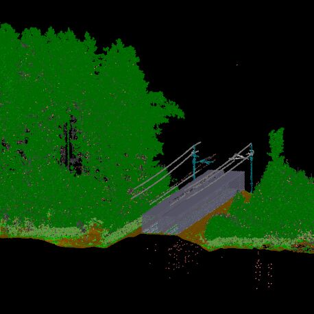
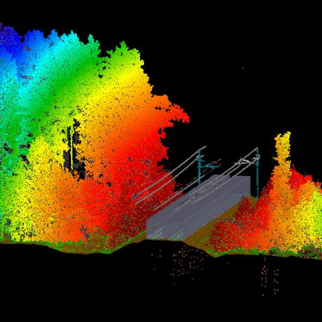
The package contains tools for the automatic classification of high-density laserscanning data (MLS/TLS) into the classes ground, walls, roofs, trees and poles. Applications are map layers (e.g. locations of trees and poles) and road inventories.
LIS Analysis
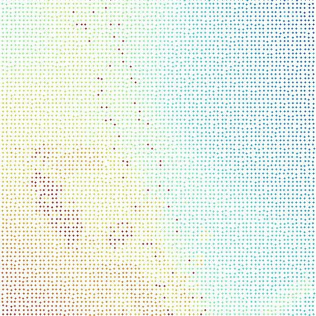
The package contains tools for the in-depth analysis of point cloud data like 3D distance measurement between two point clouds, normal vector and positional accuracy estimation, the calculation of various point features by neighborhood analysis (including height features, density features, geometric features, local plane features and Eigenvalue features), the calculation of segment features for object-based classification, statistical analyses and fuzzy c-means clustering.
LIS Arithmetic
This package contains tools for grid and point cloud arithmetics, including point cloud attribute calculations, height normalization, multitemporal change detection, volume estimation, and corridor mapping (vegetation encroachment).
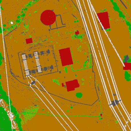
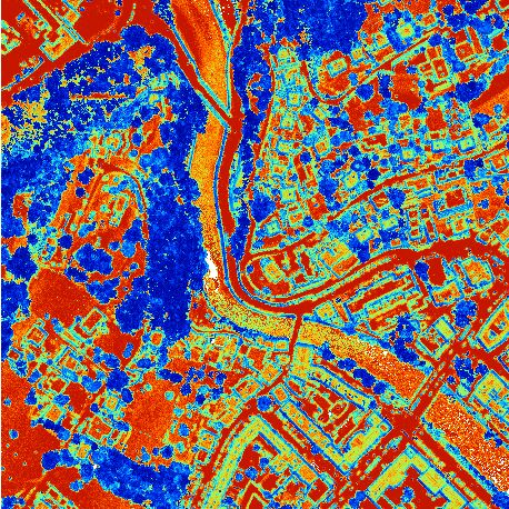
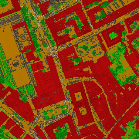
LIS Classification
The package contains tools for supervised and
unsupervised point cloud classification, including the derivation
of geometric primitives like lines, planes and volumes, and the classification of point
clouds into the classes
ground, building, vegetation, power lines and pylons.
Part of the functionality of this package is also available in the LIS ALS Classification
plug-in
for the Riegl RiPROCESS software.
LIS Colors
This package contains tools for color processing like the colorization of point clouds by orthoimages or color space conversions (RGB to HSV and vice versa).
LIS Conversion
This package contains tools for various spatial data type conversions like point cloud to raster tools (and vice versa, including a lot of additional features like different interpolation methods, statistical aggregation, point cloud normalization and classification) and tools for bounding box generation from data in different formats.
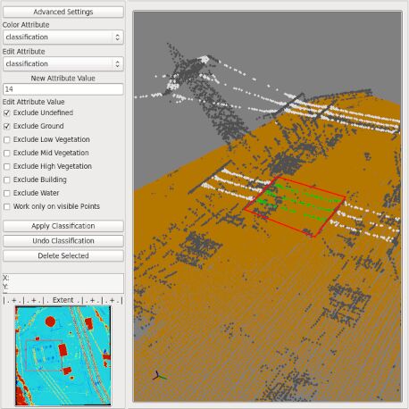
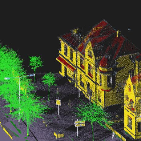
LIS Point Cloud Editor
The package contains a 3D point cloud editor which allows you to relabel point cloud attributes or to delete points. It also supports the fitting of a plane to selected points in order to derive the 3D orientation. Manifold visualization options for point clouds, raster data sets and 3D vector layers are provided. Applications are the 3D visualization and inspection of point clouds as well as the manual improvement of filtering and classification results.
LIS Filtering
This package contains tools for outlier removal from points clouds, point cloud filtering based on attributes, majority filtering of point clouds, point cloud classification based on raster surfaces and morphological filtering of raster data sets.
LIS I/O
This package extends SAGA's comprehensive import and export functionality by adding additional point cloud and vector data formats. It also includes tools for preparing files for use in virtual point cloud data sets.
LIS Orientation
The package contains tools for point cloud and image registration and orientation, including a 3D point cloud registration editor and tools for the derivation of transformation matrices as well as iterative closest point adjustment (ICP). Applications are the registration of multiple scan positions and the reconstruction of camera poses (supporting the lens types telephoto, panorama and hemisphere).
LIS Profiles
This package contains tools to query, inspect and plot transects from point clouds, raster and vector layers.
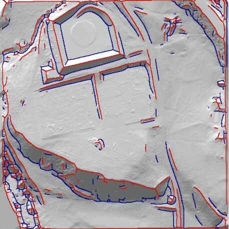
LIS Segmentation
The package contains a comprehensive set of point cloud segmentation and region growing tools, each dedicated to specialized tasks. Applications include the segmentation of point clouds by robust plane or line fitting and the segmentation of ground, building and vegetation points.
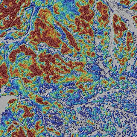
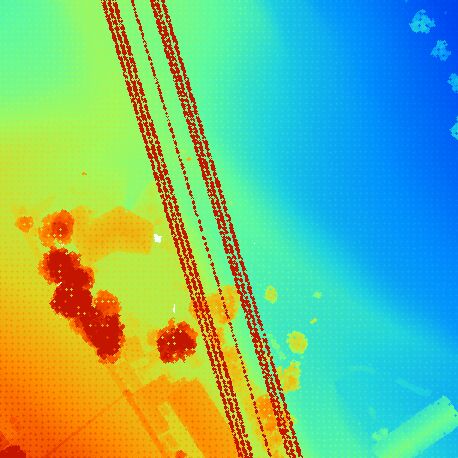
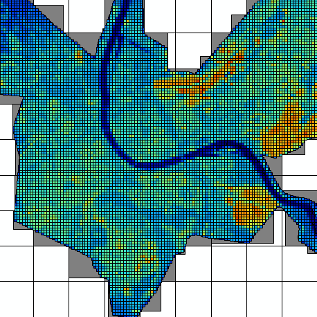
LIS Terrain Analysis
The package contains tools to derive terrain breaklines and to calculate surface roughness as well as local morphometry features like slope, aspect, curvature and shadings from point clouds. Applications are digital terrain analysis and mapping products.
LIS Thinning
This package contains tools for point cloud thinning, including 2D and 3D blockthinning, TIN-based thinning as well as tools for adaptive thinning based on local surface roughness.
LIS Tools
This package provides general tools for raster, shapes and point cloud processing, including attribute management, geometric operations (e.g. vertex manipulation, smoothing), spatial clipping and subset extraction based on attribute values as well as intensity correction.
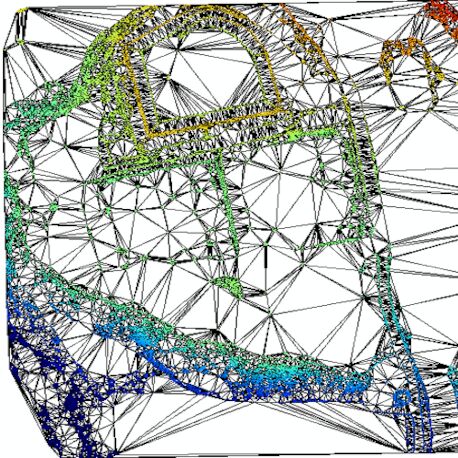
LIS Vectorizer
The package contains tools for the delineation of 3D vector representations from point cloud data. This includes (constrained) Delaunay triangulation, the creation of decimated meshes and polygon outlines from point cloud segments as well as volumetric analyses based on 3D hulls of point cloud segments.
LIS Virtual
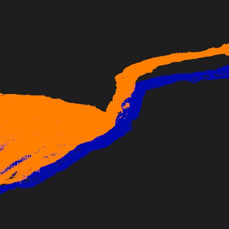
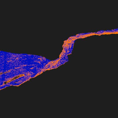
This package contains tools to create and manage data catalogs (virtual point clouds describing a mosaic of point cloud data sets). Data catalogs provide seamless data access for data dissemination and mass data processing. This includes tools for spatial subset extraction (clipping), retiling, gridding and thinning. Data catalogs can be created from SAGA point clouds, LAS/LAZ files or Riegl RDBX files.
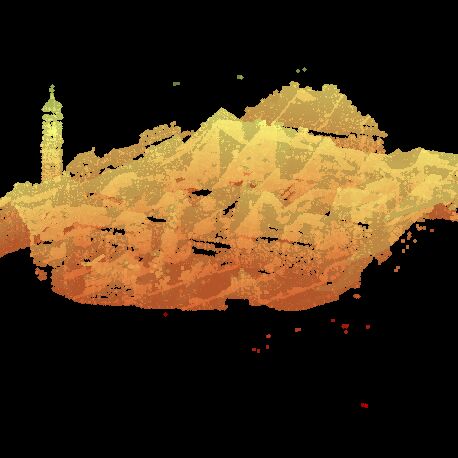
LIS Visualization
This package contains tools for the creation of visualization products from point clouds, including an orthoimager and a point cloud photographer supporting different lens types.
LIS Voxel
This package contains tools to create and analyse voxel representations of point clouds. This includes statistical measures as well as the calculation of point counts and interception ratios per voxel.

SAGA - System for Automated Geoscientific Analyses
The System for Automated Geoscientific Analyses
(SAGA) is a well known
free and open source GIS, providing a comprehensive set of processing tools for raster and
vector data.
We are contributing to the project on different levels being part of the SAGA GIS
development team,
maintainer of the project web page and user forums, and funding member of the SAGA User
Group Association.
We provide professional services for SAGA, including consultancy, automation (scripting) and
tool development.
Most of the project resources are hosted on sourceforge,
including binaries, source code, documentation/tutorials, user forums, wiki and bug tracker.
Besides that,
additional information like references (documentation, research papers, API reference, tool
reference) can be
found on the project's
homepage.