
LIS City Modeller
Building models
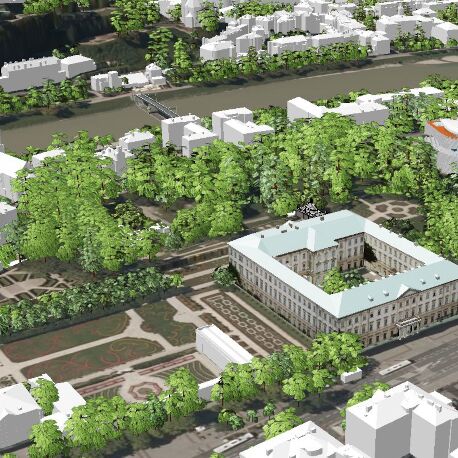
LIS City Modeller provides tools for the automated derivation of building footprints and 3D building models from point cloud data. The extension supports LOD0 building footprints as well as LOD1 and detailed LOD2 representations, including roof segmentation and assignment of roof structures to individual buildings. Typical applications include producing municipal or regional 3D city models from airborne LiDAR, updating building footprints after new surveys, reconstructing roof geometries for urban planning, and generating building models for applications such as solar-potential analysis, visualisation and other urban analyses.
Tool: Assign Roof Segments to Buildings
| Features |
|---|
| • assign building roof segments to building footprints provided in a polygon shapes layer |
| • invalidate roof overhangs extending into a footprint from a neighboring footprint |
| Applications |
|---|
| • point cloud preprocessing for LOD2 building modelling |
Tool: Building Aware Point Cloud Tiling
| Features |
|---|
| • adaptive tiling, each building is completely in one tile |
| • works with available building identifiers or creates identifiers by spatial region growing |
| Applications |
|---|
| • preparation of point cloud data for building modelling |
| • mass data processing |
Tool: Export Shapes to CityGML
| Features |
|---|
| • export of 3D building shapes layers to a CityGML 2.0 file making use of additional information |
| • export special attributes of the CityGML standard like measured height or postal adresses |
| • export all other attributes as generic attributes, e.g. building capacity |
| • export geometries as MultiSurface or Solid with user-defined coordinate precision |
| Applications |
|---|
| • export of building models to CityGML for use in third party software |
Tool: Export Shapes to CityJSON
| Features |
|---|
| • export of 3D building shapes layers to a CityJSON file making use of additional information |
| • export special attributes of the CityJSON standard like measured height or postal adresses |
| • export all other attributes as generic attributes, e.g. building capacity |
| • export geometries as MultiSurface or Solid with user-defined coordinate precision and compression (optional) |
| Applications |
|---|
| • export of building models to CityJSON for use in third party software |
Tool: LOD0/1 Building Modeller
| Features |
|---|
| • creation of polygonal shapes of buildings from a point cloud which has individual buildings labelled by unique identifiers |
| • support of two levels of detail: (i) 2D polygonal shapes of the building footprints (LOD0) and (ii) 3D polygonal shapes from extruded building footprints (LOD1) |
| • outline simplification and rectification |
| • courtyard detection (based on minimum gap area) |
| • derived attributes: building area, building elevations (min, max, mean, median, standard deviation), building volume |
| Applications |
|---|
| • derivation of building footprints (LOD0) |
| • derivation of 3D building models (LOD1) |
| • map layers and 3D city models |
| • spatial planning |
Tool: LOD2 Building Modeller
| Features |
|---|
| • creation of LOD2 building models (with roof structures) from a from a point cloud, a raster DTM and building footprints |
| • data driven modelling of the building roof structures (no usage of roof templates) |
| • outline simplification and polygon rectification |
| • derived attributes: building identifier and surface class (ground, wall, roof) |
| Applications |
|---|
| • derivation of 3D building models (LOD2) |
| • map layers and 3D city models |
| • 3D visualization products, e.g. for architecture, spatial planning, tourism, virtual reality, gaming |
Tool: LOD2 Building Statistics
| Features |
|---|
| • calculation of various statistics and measurements for LOD2 building models |
| • attributes get attached to the building models |
| • derived attributes: building capacity, building capacity above ground, eaves elevation, maximum elevation (gable elevation), mean elevation, minimum elevation, measured height, slope of roof, aspect of roof |
| Applications |
|---|
| • enrichment of 3D building models (LOD2) with additional information |