LIS Plug-ins for Riegl Software Packages
Since 2018, LASERDATA is developing software plug-in solutions for the global laser scanner manufacturer RIEGL LMS GmbH based in Horn, Austria. These include the classification of airborne laser scanning data (LIS ALS Classification Plugin for RiPROCESS), geological structural analyses (LIS GeoTec Plugin for RiSCAN PRO) or individual tree analyses (LIS TreeAnalyzer Plugin for RiSCAN PRO) from terrestrial laser scanning data.
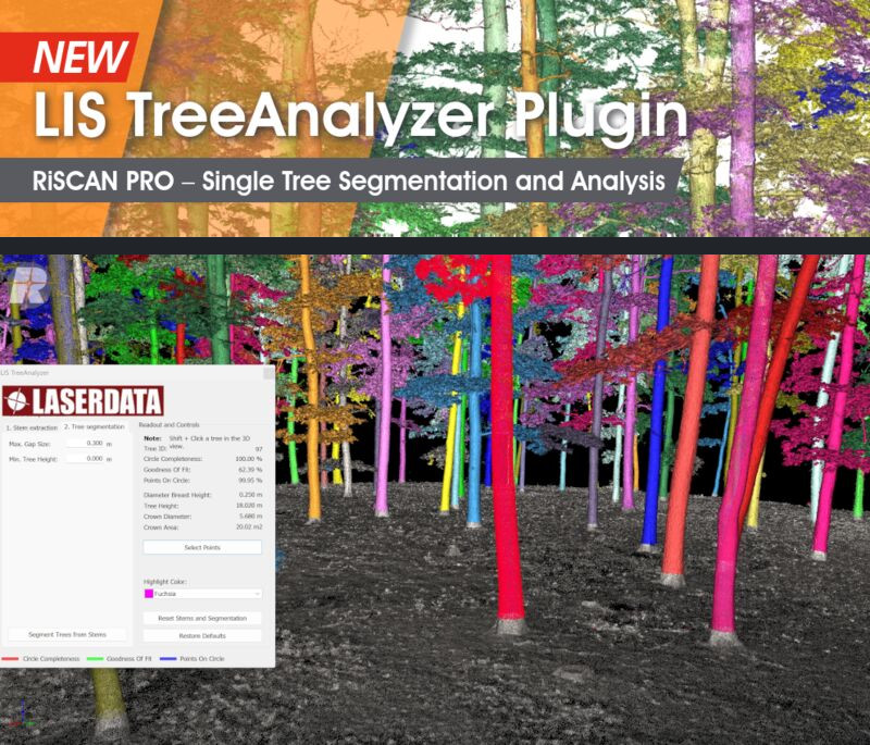
LIS TreeAnalyzer Plug-in
The RiSCAN PRO plug-in enables the automatic extraction of various individual tree parameters from terrestrial point clouds. In addition, a 3D pipe model is created for each tree - this is used to perform a highly accurate volume calculation. Calculated tree parameters:
- georeferenced tree position
- tree ID
- wood volume calculation
- tree height
- crown area
- crown diameter
For further inquiries and pricing information please contact c9baa8a5acba89bba0acaea5e7aaa6a4
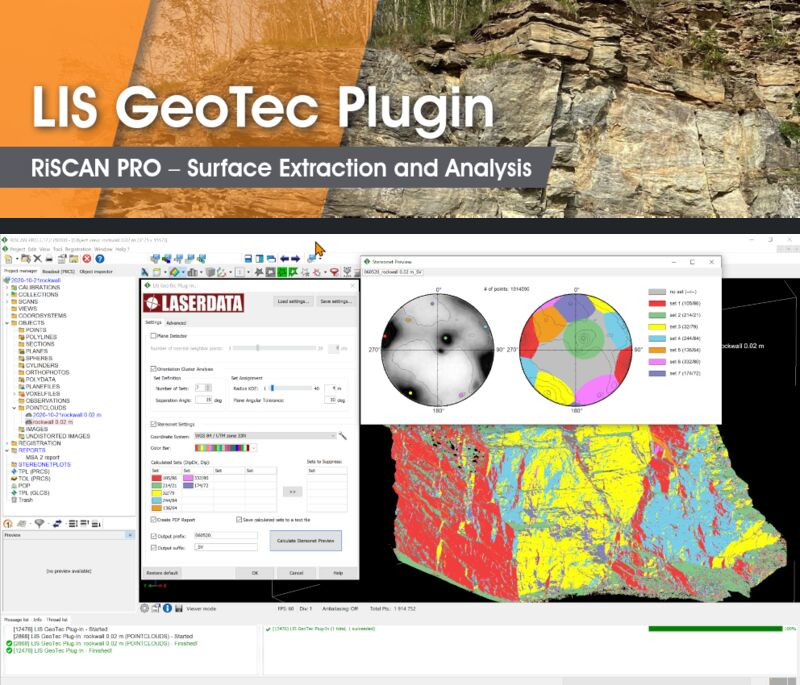
LIS GeoTec Plug-in
The RiSCAN PRO plug-in enables the geotechnical analysis of scanned rock surfaces. It facilitates the calculation of surface normals for a local neighborhood. These surface normals are further analyzed to detect clusters of pre-dominant surface orientations, which are used for data classification and visualization on a polarplot diagram. Calculated point attributes:
- surface normal
- discontinuity set ID
- dip & dip direction angles
- dip & dip direction angles of the assigned set
- dip & dip direction RGB color encoded
For further inquiries and pricing information please contact c9baa8a5acba89bba0acaea5e7aaa6a4
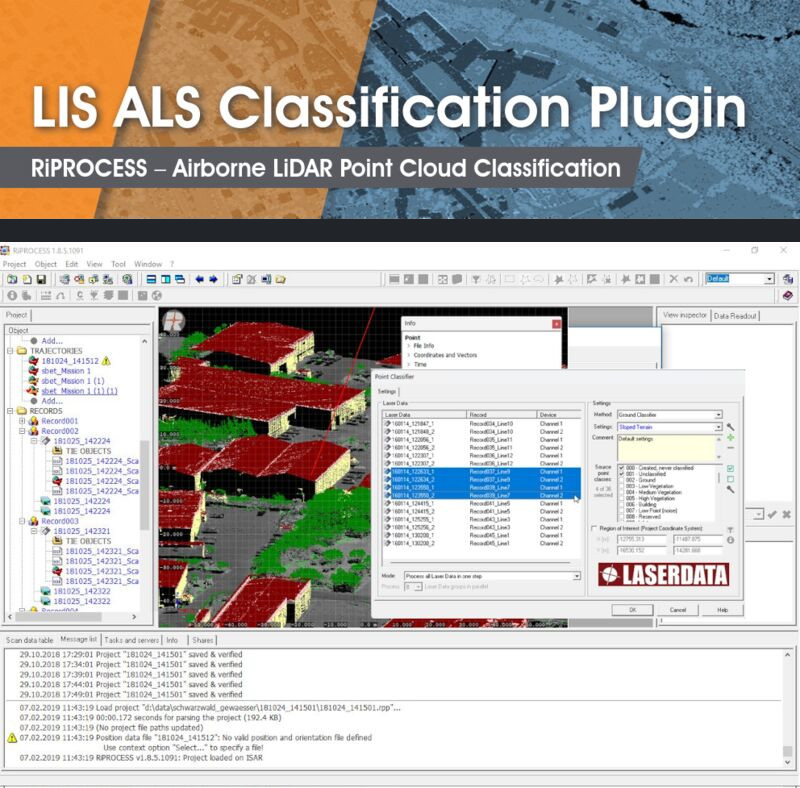
LIS ALS Classification Plug-in
The RiPROCESS plug-in facilitates the classification of point cloud data into ground, building and vegetation points. It is fully integrated into the RiPROCESS data processing software package and works directly on the project's RDB2 point cloud data.
- Ground classifier:
The ground classifier, based on a progressive TIN densification, separates ground and non-ground points. It provides three settings for flat, sloped and steep terrain. Additional fine tuning of parameters is possible in the advanced settings. - Vegetation and Building classifier:
The building and vegetation classifier further separates all non-ground point into the classes building, vegetation and undefined. Buildings are detected by point cloud segmentation and analysis of the local point neighbourhood. Vegetation points are sliced into low, medium and high vegetation.
For further inquiries and pricing information please contact c9baa8a5acba89bba0acaea5e7aaa6a4