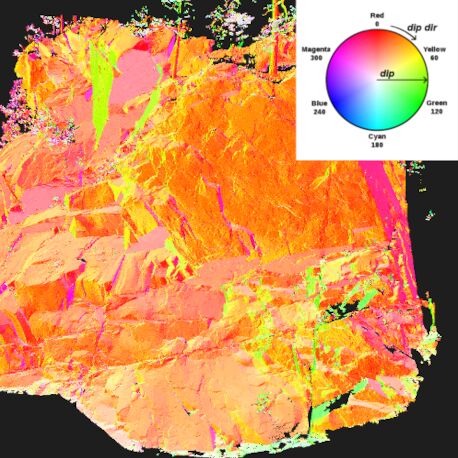

LIS Geology
Joint set and failure
analyses
LIS Geology provides specialised tools for extracting and analysing geological structures
from high-resolution terrain and point cloud data. The extension supports the determination
of bedding orientations, identification of discontinuity sets and individual joint planes,
joint-spacing analysis and kinematic failure assessment. Typical applications include
analysing terrestrial laser scans of rock faces, automatically mapping joint and
discontinuity orientations, estimating potential rock-block dimensions, producing
stereographic plots, and assessing possible planar, wedge or toppling failures for rock
slopes, quarries and engineering sites.
Part of the functionality of this extension is also available in the LIS GeoTec plug-in
for the Riegl RiSCAN PRO software.
Tool: Bedding Orientation
| Features |
|---|
| • estimation of the 3D orientation of bedding planes from a DTM and lineaments |
| • inputs: raster DTM, line shapes layer |
| • outputs: line shapes layer with the attributes dip direction, dip, strike, and quality measures |
| Applications |
|---|
| • determination of bedding orientations |
| • engineering geology and geotechnical engineering |
Tool: Bedding Orientation [interactive]
| Features |
|---|
| • estimation of the 3D orientation of bedding planes from a DTM and digitized lineaments |
| • input: raster DTM |
| • outputs: digitized line shapes layer with the attributes dip direction, dip, strike, and quality measures |
| Applications |
|---|
| • determination of bedding orientations |
| • engineering geology and geotechnical engineering |
Tool: Discontinuity Sets
| Features |
|---|
| • pole plot creation from proint cloud with normal vectors (equal-area stereonet) |
| • determination of discontinuity sets from a point cloud with pre-computed normal vectors and a pole plot of the normals |
| • Kernel Density Estimation to detect poles of potential discontinuity sets |
| • constraining parameters for final pole detection: maximum number of sets and minimum normal difference between the poles |
| • constraining parameter for point labelling: maximum normal difference between the point’s normal and the normal of the set’s pole |
| • outputs: derived poles and their orientation, stereoplot showing the set ID assignment |
| • optional point cloud output attributes: joint plane ID, joint set ID, set normal, dip direction, dip |
| Applications |
|---|
| • plotting of the spatial orientation of planes |
| • determination of discontinuity sets and their orientation within a rockface |
| • dip direction and dip computation |
| • visualization of processing results |
| • engineering geology and geotechnical engineering |
Tool: Discontinuity Spacing
| Features |
|---|
| • determination of the discontinuity spacing of rock masses |
| • input: point cloud with derived discontinuity sets |
| • output: (non-persistent) discontinuity spacing |
| • spacings of each set are reported both as cumulative frequency distribution and histogram |
| • information on set orientation and spacing statistics is reported in a table |
| • optional output: measurement graph as 3D shapes layer and midpoints of the edges of the measurement graph as point cloud (attributes: set ID, joint plane IDs used for measurement, measured distance) |
| Applications |
|---|
| • determination of the discontinuity spacing of rock masses |
| • statistics of discontinuity spacing |
| • creation of maps with mean spacing (per set) |
| • creation of fracture density maps |
| • rock slope stability analysis |
| • derivation of block size distributions |
| • engineering geology and geotechnical engineering |
Tool: Kinematic Slope Analysis
| Features |
|---|
| • slope failure analysis based on Markland's test |
| • input: point cloud with normal vectors and joint plane IDs |
| • supported mechanims: plane failures, toppling failures, wedge failures |
| • output: point cloud attribute with failure classification |
| Applications |
|---|
| • kinematic slope analyses |
| • slope failure analyses |
| • 3D mapping of slope failure mechanisms |
| • engineering geology and geotechnical engineering |
Tool: Label Joint Sets
| Features |
|---|
| • label joint sets in a point cloud based on user-defined values of dip direction and dip per set |
| • labeling is controlled by an angle threshold (maximum angular difference between set and point normal) |
| Applications |
|---|
| • visualization of discontinuity sets and their orientation within a rockface |
| • engineering geology and geotechnical engineering |